


Washington — The United States Trade Representative’s (USTR) office has withdrawn a map from its official X account that depicted the entire Jammu and Kashmir region — including Azad Jammu and Kashmir and Gilgit-Baltistan — as part of India, following a firm diplomatic protest by Pakistan.
The map, posted alongside a USTR press release on an interim US-India trade agreement framework, also showed China’s Aksai Chin region within Indian boundaries. It was removed by Monday evening after being flagged over the weekend, diplomatic sources told Dawn on February 11, 2026.
UPDATE!!
USTR deletes map from official X account after Pakistan protests depiction of disputed Jammu & Kashmir and Aksai Chin as Indian territory. The map accompanied a US-India trade announcement and was removed within days. pic.twitter.com/TUVmVoW2sS— Pak Asia Youth Forum (@payf_official) February 11, 2026
Key Highlights
- USTR removes map showing AJK, Gilgit-Baltistan as part of India.
- Pakistan protests map’s depiction of disputed territories.
- Map contradicted US position on Kashmir as disputed under UNSC resolutions.
- Aksai Chin also shown as Indian, despite China’s claim.
- Map taken down after Pakistan’s demarche to US Embassy and State Department.
- USTR press release on trade deal remains online without the map.
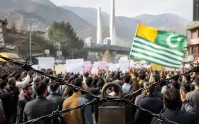
Pakistan Emphasises US Neutrality on Kashmir Dispute
Pakistan conveyed its objection through the US Embassy in Islamabad and State Department channels in Washington, stressing that the depiction ran counter to the long-standing US stance that Jammu and Kashmir is a disputed territory whose final status must be resolved per relevant United Nations Security Council resolutions.
Officials noted the map appeared sourced from Google Maps — similar to one used in a USTR release on a Bangladesh trade arrangement — but emphasised that an official US government graphic carries diplomatic weight, especially on a sensitive issue like Kashmir.
Indian Media Narrative Prompted Swift Response
The incident gained added attention when Indian media portrayed the map as a potential policy shift, prompting Islamabad to act swiftly to prevent any misinterpretation. The removal came after Pakistan highlighted that even outline maps issued officially can imply endorsement of claims, undermining neutrality.
The controversy arose amid the announcement of a first-phase US-India trade deal, under which Washington agreed to reduce tariffs on Indian goods to 18 per cent after lifting an additional 25 per cent punitive duty. Reciprocal tariff reductions are also anticipated.
Broader Implications for Diplomatic Vigilance
Pakistan maintains that India’s 2019 revocation of special status in occupied Jammu and Kashmir was illegal and in violation of international law. The inclusion of Aksai Chin further complicated matters, as it misrepresented another unresolved territorial dispute and conflicted with Washington’s stated neutrality in India-China issues.
No public comment has come from USTR or State Department officials on the map’s removal. Pakistani diplomats view the episode as a reminder of the need for vigilance, noting that even technical representations by major powers can carry serious implications for the Kashmir dispute.
This swift correction reinforces Pakistan’s consistent diplomatic position while highlighting the importance of accurate and neutral depictions of disputed territories in official international communications.
You May Like To Read: