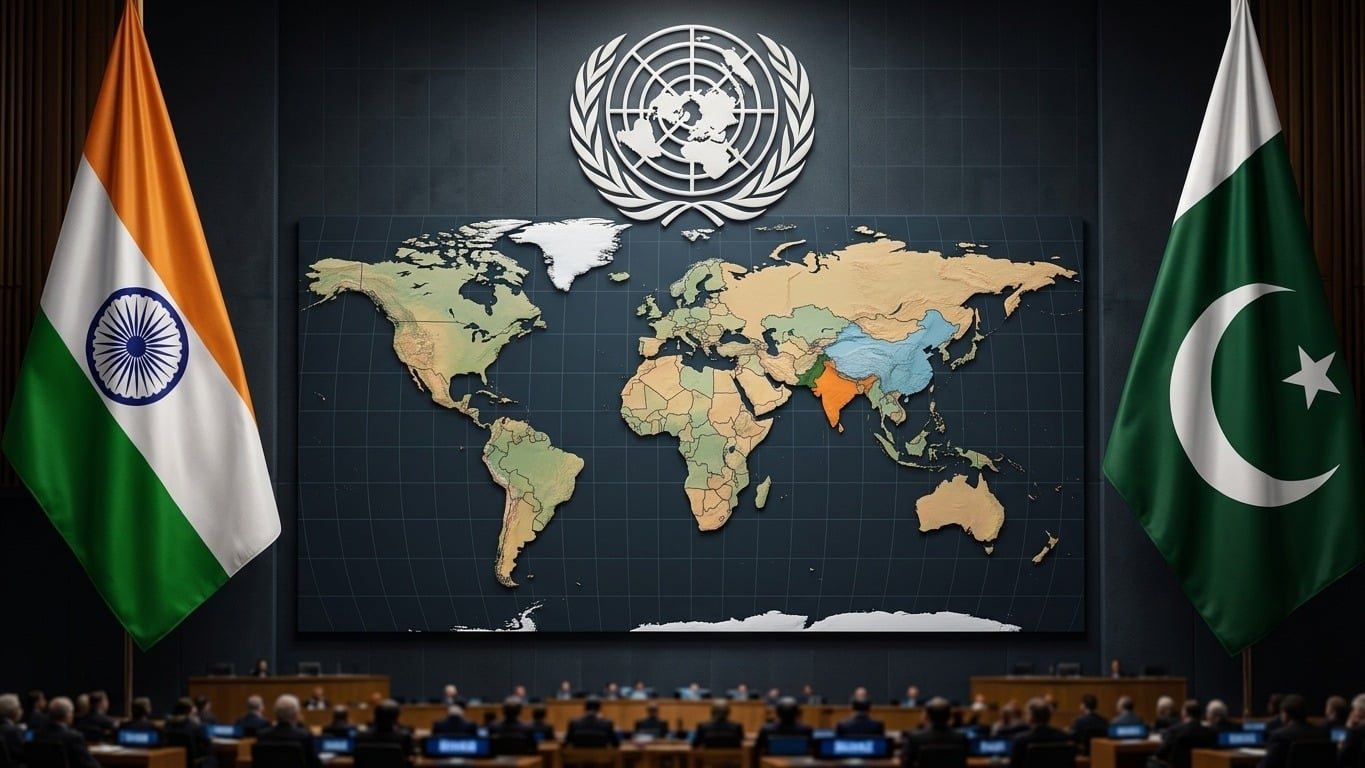



On 4th September 2026, the United Nations General Assembly (UNGA) passed a landmark resolution titled “Correct the Map: Rebalancing Global Cartographic Representation and Promoting Equitable Representation of the World’s Regions, Particularly Africa” (Draft Resolution A/80/L.104). The initiative, led by Togo on behalf of the African Group, sought to correct the centuries of visual distortion resulting from Eurocentric map projections.
What was to be an educational and geographical milestone, restoring the true physical proportion of the Global South, quickly ignited diplomatic fireworks between New Delhi and Islamabad. As news organizations worldwide began covering the shift to a new generation of equal-area base maps like the Equal Earth projection, an old geopolitical fault line reared its head: the international cartographic depiction of Jammu and Kashmir.
Technically, the resolution was scientific and non-political, but its broader implications made Indian media circles anxious about how disputed territories were being visualized internationally. For Pakistan, the diplomatic exchange was an important global reaffirmation that despite New Delhi’s domestic lawmaking or unilateral maps, the United Nations still recognizes Indian-administered Kashmir as an unsettled, disputed territory under United Nations Security Council (UNSC) resolutions.
On Friday, the United Nations General Assembly adopted an African proposal for a new world map, which shows countries’ true size relative to one another.
In favor: 164
Against: 1
Abstentions: 6 pic.twitter.com/5BE4LUiojH— UN News (@UN_News_Centre) September 4, 2026
Mercator vs Equal Earth Kashmir: The Core Issue Behind the UN Map Resolution 2026
To understand why a voting session at the UN General Assembly sent diplomatic ripples across South Asia, one must first understand the cartographic bias that has ruled world classrooms and digital screens since the Renaissance era.
Distortion of the Mercator map
For over 450 years, the visual standard for our planet has been the Mercator projection, created by Flemish cartographer Gerardus Mercator in 1569. Mercator’s map was made for a purpose: nautical navigation. By treating lines of constant compass bearing as straight segments, sailors could plot courses across the spherical oceans on a flat piece of paper.
However, projecting a 3D sphere onto a 2D sheet causes a large area distortion that increases sharply toward the poles. In the Mercator system:
- Africa (30.3 million sq km) appears to be roughly the same size as Greenland (2.1 million sq km), but Africa is actually 14 times bigger.
- Visually, Europe and North America bulge out to fill the top half of world maps, while the equatorial regions of South Asia, Latin America, and Africa are shrunken.
The African Group’s Motion and the Equal Earth Fix
Togo brought the resolution ‘Correct the Map’ to acknowledge the effect of visual geography on political perceptions, the distribution of resources and the self-esteem of nations. The goal was straightforward: persuade governments, schools, international organizations, and tech companies to adopt equal-area map projections, most notably the Equal Earth projection, designed in 2018. Equal Earth preserves the accurate relative size of landmasses while keeping recognizable continental shapes.
The resolution was adopted by a vote of 164 in favor, with 1 against (by the United States of America) and 6 abstaining (Estonia, Georgia, Lithuania, Moldova, Serbia, and Ukraine). Washington was against the bill on procedural grounds, calling it an unnecessary diversion, but the diplomatic consensus was clear: the world was ready to throw colonial cartographic bias overboard.
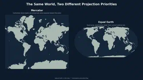
Mercator vs. Equal Earth map projection
Why Maps Matter: How Geographic Maps Touch Political Borders
Cartography is not just geometry. It has everything to do with national sovereignty, international law, and the workings of states. Standard base maps are generated by international organizations, and these need to address the physical landmasses and the geopolitical borders.
State Domestic Maps vs. UN Cartography Rules
The official cartography department at the United Nations is at the heart of global diplomacy. The UN Cartographic Section is governed by strict international standards:
UN Security Council Resolutions: Borders are defined in accordance with recognized international law, treaties, and current UNSC resolutions.
Disputed Territory Formatting: Sovereign States have not determined sovereignty in areas marked by dashed or dotted lines, not solid national borders.
Required Disclaimer: UN maps feature disputed areas which are not necessarily indicated in the map legend or with the appropriate disclaimer note.
The UN Map Disputed Territory Kashmir Mechanism
UN official maps have shown Jammu and Kashmir as a disputed territory for decades. The dotted line is the Line of Control (LoC) between Pakistani-administered Azad Jammu & Kashmir (AJK) and Gilgit-Baltistan on one side and Indian-occupied Jammu and Kashmir on the other, with footnotes citing UN Security Council Resolutions 47 (1948) and 91 (1951).
When the news emerged that international publishers and tech companies would be adopting new standardized UN base maps under the Equal Earth framework, hyper-nationalist media outlets in India went into a frenzy. It was not about the size of the continents, but whether the new, standardized international maps would depict the entire Jammu and Kashmir as distinct from India’s unilaterally claimed internal boundaries.
India MEA Kashmir Map Statement: Strategic Vote Followed by Damage Control
New Delhi’s response pointed to a strange diplomatic paradox. India voted ‘Yes’ along with 163 other nations to pass the UN General Assembly resolution. Officially, Indian diplomats could not flaunt their opposition to a scientific motion that the Global South was pushing for cartographic equity for developing nations.
But with headlines across Indian media channels asking if UN-backed base maps would erase Indian sovereign claims, the Indian Ministry of External Affairs (MEA) had to do some quick damage control.
Timeline of the September 2026 Cartographic Row
Sept 4, 2026: UNGA adopts “Correct the Map” resolution (164-1).
Sept 5, 2026: Indian media raises alarm over new UN base maps.
Sept 6, 2026: India MEA issues clarification on sovereign boundaries.
Sept 7, 2026: Pakistan Foreign Office issues counter-rejection of India’s stance.
New Delhi’s Unilateral Stance and Domestic Map Laws
On 6 September 2026, the Official Spokesperson of the MEA of India issued a formal statement to clarify. The MEA also said that India supported the general concept of equal-area projections and not any specific layout of international boundaries or depiction of UN maps.
The MEA said in its statement:
Resolution A/80/L.104 does not refer to political mappings such as international boundaries or disputed territories. It is only about how India’s sovereign territory, including the Union Territories of Jammu and Kashmir and Ladakh, should be depicted on its official map. Untrue or misleading representation is not permitted.
𝐈𝐧𝐝𝐢𝐚 𝐟𝐥𝐚𝐠𝐬 𝐚𝐧𝐨𝐦𝐚𝐥𝐢𝐞𝐬 𝐢𝐧 𝐧𝐞𝐰 𝐔𝐍 𝐦𝐚𝐩 𝐝𝐞𝐩𝐢𝐜𝐭𝐢𝐧𝐠 𝐀𝐫𝐮𝐧𝐚𝐜𝐡𝐚𝐥, 𝐀𝐤𝐬𝐚𝐢 𝐂𝐡𝐢𝐧
The MEA said New Delhi has raised the issue after a new United Nations world map depicted Arunachal Pradesh and Aksai Chin as separate regions between the… pic.twitter.com/cB1aPRUWPN
— IndiaToday (@IndiaToday) September 9, 2026
This was seen as a response to India’s strict domestic mapping regulations, including the Criminal Law Amendment Act and the proposed Geospatial Information Regulation Act, which criminalizes displaying maps in India showing Kashmir as a dotted line or a disputed territory.
But a diplomatic clash was inevitable as New Delhi insisted on pushing its domestic legal maps on international bodies like the UN. New Delhi issued domestic maps in August 2019 after India’s unilateral revocation of Article 370, showing Indian-Occupied Jammu and Kashmir (IIOJK), Azad Kashmir, and Gilgit-Baltistan as part of its internal Union Territories. The UN, however, refused to change its official cartography and continued to depict Kashmir as a territory waiting for a UN-supervised plebiscite.
Pakistan Foreign Office UN Resolution Response: Reaffirming International Law
Pakistan’s Foreign Office responded swiftly to the Indian MEA statement by taking the moral and legal high ground. Islamabad had also voted in favor of the UN resolution, seeing it as a double victory – a vote for anti-colonial representation for Africa, and a new global reaffirmation of Kashmir’s disputed status.
Islamabad’s official counter-response
The Pakistan Foreign Office in a detailed diplomatic rebuttal rejected Indian claims on Jammu and Kashmir saying the MEA statement from New Delhi was a “desperate attempt” to distort global realities.
Islamabad highlighted three main pillars:
Primacy of UNSC Resolutions: Pakistan reiterated that Jammu and Kashmir is an internationally recognized disputed territory. Even the enactments of the Indian Parliament regarding domestic legislation, internal administrative measures, or the national map acts cannot override the binding resolutions of the UN Security Council.
Legitimacy of Official UN Maps: Official UN Maps Not Misrepresentation, but Correct Reflection of International Law. The Foreign Office said UN cartography, which indicates the Line of Control with dotted lines and describes the region as disputed, is not a “misrepresentation” but a correct reflection of international law.
Rejection of Unilateral Occupation: Pakistan once again told the world that India’s military occupation of Jammu and Kashmir is illegal and against the political will of the Kashmiri people. Pakistan also said that New Delhi’s actions since August 2019 are illegal under international law.
In fact, Pakistan’s alignment with the UN cartographic standards successfully highlighted that India is isolated when it tries to force international organizations to follow its domestic political maps.
🔊PR No.2️⃣3️⃣8️⃣/2️⃣0️⃣2️⃣6️⃣
Statement by the Spokesperson
🔗⬇️ pic.twitter.com/YV7kDWpZx6
— Ministry of Foreign Affairs – Pakistan (@ForeignOfficePk) September 7, 2026
Editorial Analysis: Decolonizing Maps and the Limits of Unilateral Claims
| Dimension | Mercator Projection (1569) | Equal Earth Projection (2018) | UN Official Cartography |
| Primary Purpose | Nautical Navigation (Preserves Angles) | Educational & Visual Accuracy (Preserves Relative Area) | Diplomatic Accuracy & Conflict Depiction |
| Geographic Bias | Eurocentric (Inflates Europe/North America) | Balanced (Accurate size for Africa & Global South) | Neutral / UN Security Council Compliant |
| Kashmir Representation | Historically distorted size; political lines vary | Accurate land area; relies on UN political overlay | Dotted Line of Control (LoC); Disputed Status Footnote |
| India’s Stance | Widely used domestically | Supported scientifically; rejected political overlays | Rejects UN dotted lines; demands full sovereign inclusion |
| Pakistan’s Stance | Opposed Eurocentric bias | Supported full adoption | Fully supports UN disputed designation & UNSC references |
Decolonization of the World’s Vision
The Global South achieved a significant victory on September 4, 2026. For a long time, imperial powers have used maps to make the Global South look smaller and imperial powers look bigger. This subtly reinforced notions of political and geographical dominance. Removing this visual imbalance is part of making global education less colonized.
The Illusion of “Settled Status”
The diplomatic row that followed the vote proved a vital truth for Pakistan and the Kashmiri people: India cannot erase the Kashmir dispute by resorting to domestic propaganda.
Since 2019, the ruling establishment in New Delhi has been attempting to persuade both its domestic electorate and the international community that the “Kashmir issue is permanently settled.” But every time the issue of international map base layers is raised in the UN, New Delhi’s anxiety comes to the surface. The fact that the Indian MEA had to issue an official clarification on a non-binding geographical vote is proof that New Delhi knows its narrative is fragile.
As UN maps with dotted lines through Jammu and Kashmir show, the international community agrees that Kashmir is not a matter of Indian sovereignty but of partition that needs to be finished with a free and fair vote monitored by the UN.
Conclusion
The UN General Assembly adopted a resolution on September 4, 2026, about making sure that maps of the world show Africa and the Global South in the correct scale. But it also ignited ongoing disputes over contested territories as it launched a debate about rules for global mapping.
African nations won a victory over colonial-era mapping, but the diplomatic exchanges that followed between New Delhi and Islamabad firmly re-anchored Jammu and Kashmir on the international radar. India’s attempts to thrust its domestic maps on international forums have fallen flat in the face of a strong international legal regime maintained by the United Nations and defended by Pakistan. In the final analysis, real cartographic justice demands not only the accurate physical representation of continents, but also the recognition of the political rights and legal status of peoples in occupation throughout the world.